


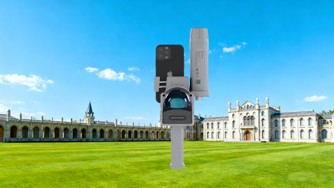


Modello FJD Trion per scanner LiDAR 3D FJD Trion
Tasse incluse. Spedizione calcolata al checkout
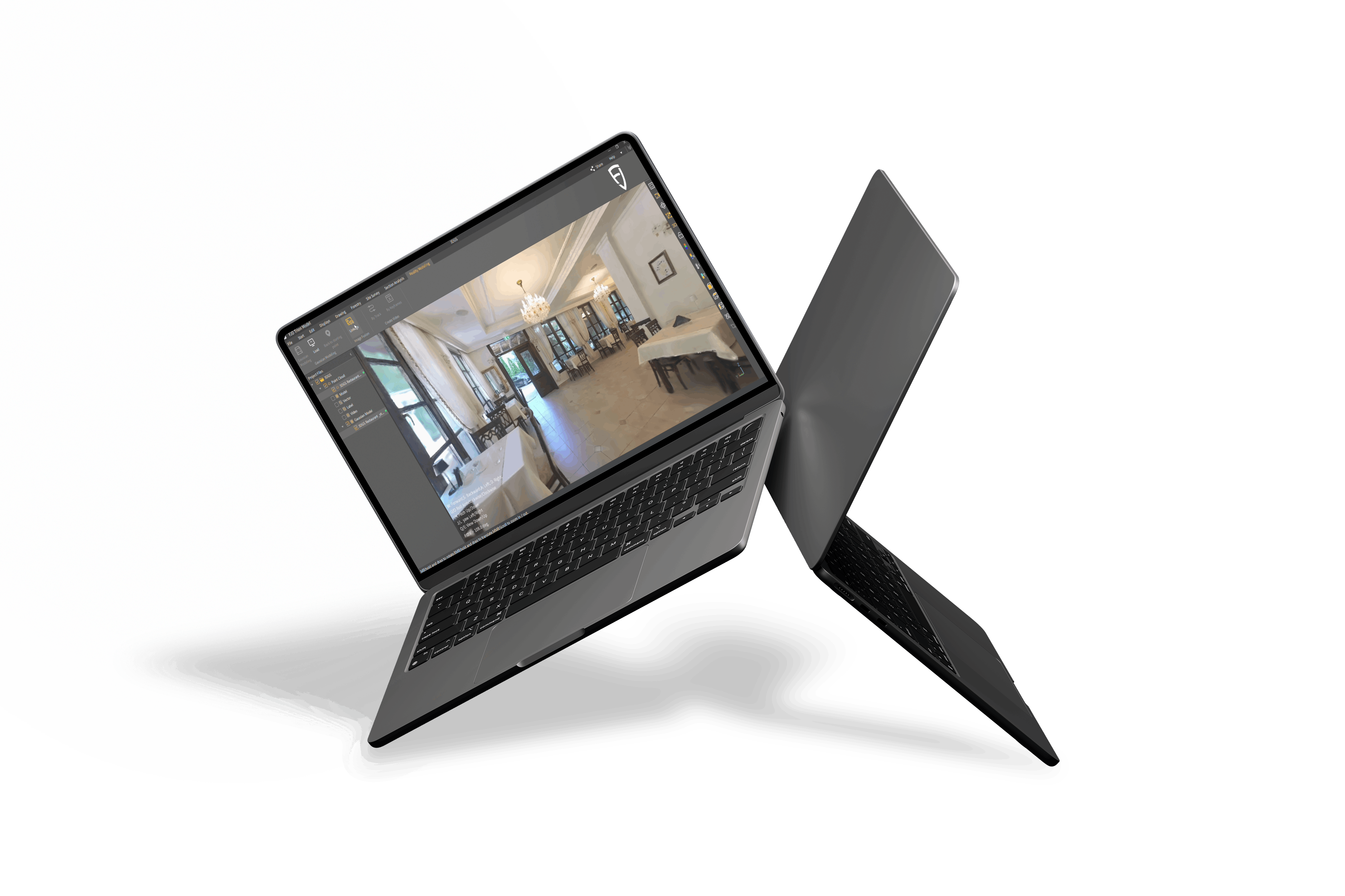
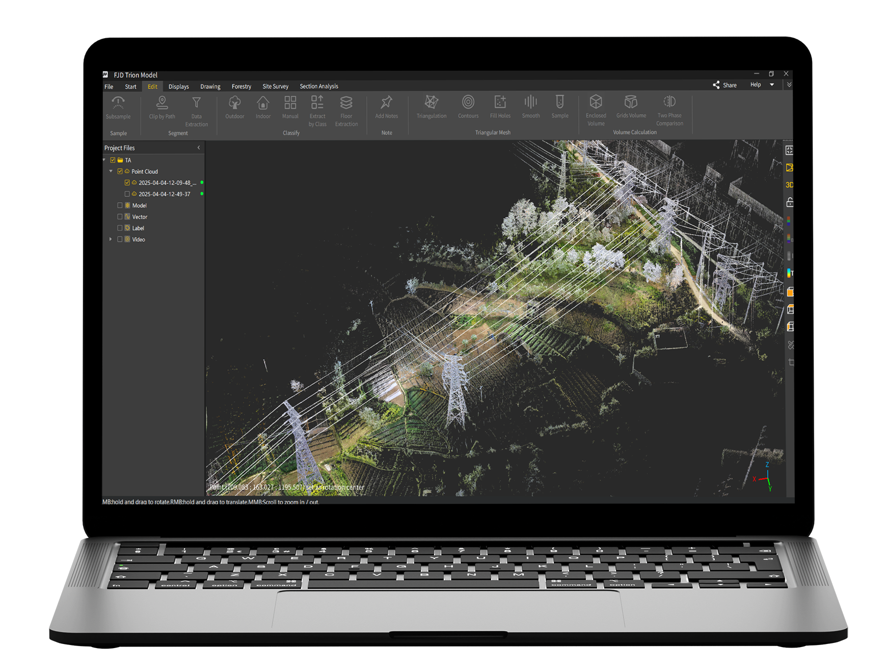
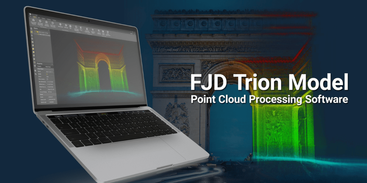
Software di elaborazione di nuvole di punti modello FJD Trion
-
Funzionamento intuitivo e supporto algoritmico avanzato
-
Soluzione versatile all-in-one con moduli integrati
-
Tecnologia efficiente di splatting gaussiano 3D
-
Compatibilità multipiattaforma ed elaborazione in movimento
-
Funzioni di elaborazione essenziali complete
-
Condivisione dati conveniente e flussi di lavoro collaborativi
-
Scenari applicativi ad ampio raggio
*La chiave del prodotto è compatibile solo con lo scanner FJD Trion 3D Lidar.


Rendi la nuvola di punti facile da usare
Grazie all'interfaccia intuitiva e all'algoritmo all'avanguardia, FJD Tion Model semplifica la manipolazione e l'analisi dei dati delle nuvole di punti. Integrato con i moduli forestali, di disegno e di mappatura robotizzata, il modello semplifica il processo di importazione e analisi dei dati, rendendolo una soluzione completa. Cerchi un software di elaborazione delle nuvole di punti versatile, efficiente e ad alto livello di integrazione? Il modello è la scelta perfetta per te!
Supporta varie fonti di dati. Il modello FJD Trion supporta i dati raccolti da scanner portatili, scanner statici, lidar aerei e veicoli autonomi e supporta i formati di dati point cloud più diffusi, come LAS, PLY, PTS ed E57.
Soluzione all-in-one. Oltre all'elaborazione di base delle nuvole di punti, alla colorazione delle nuvole di punti e alle capacità di georeferenziazione, FJD Trion Model integra anche varie applicazioni specifiche del settore, come la pianificazione urbana, la silvicoltura, l'attività mineraria e la mappatura robotica.
Rendering di nuvole di punti. Grazie al rendering completo degli attributi della nuvola di punti, come intensità, elevazione e tempo GPS, la nuvola di punti è semplice e facile da comprendere.

FJD Trion Model Point Cloud Processing Software
3D Gaussian Splatting
Essential Processing Functions
 | One-Click CorrectionCorrect point cloud tilt with a single click. |
Profile AnalysisMeasure and display multiple cross-sections to evaluate point cloud data quality. | |
Volume CalculationCalculate stockpile and enclosed volumes. | |
Auto ClassificationAutomatically classify point cloud data related to buildings, trees, and geological features for urban planning, forestry, and mineral exploration. |
One-Click CorrectionCorrect point cloud tilt with a single click. |
Profile AnalysisMeasure and display multiple cross-sections to evaluate point cloud data quality. |
Volume CalculationCalculate stockpile and enclosed volumes. |
Auto ClassificationAutomatically classify point cloud data related to buildings, trees, and geological features for urban planning, forestry, and mineral exploration. |
Professional Applications
Auto Contour ExtractionExtract vector contour lines from point cloud data with one click. | Forestry ParametersEdit segmentation results to extract tree location, height, and crown width, and batch-extract attributes to create reports that provide valuable forest survey, management, and planning insights. |
 | Recommended system requirements for FJD Trion Model App |
Simpler Point Cloud Processing
Clearer Point Cloud Rendering Effect
Faster Sharing after Post-processing
Application Scenarios

Residential Real Estate

Travel & Hospitality

Commercial Real Estate

Architecture, Engineering &Construction
Confronto
- Somiglianze
Versione base
Versione Pro
sì
sì
sì
sì
sì
sì
sì
sì
sì
sì
sì
sì
sì
sì
sì
sì
sì
sì
sì
sì
sì
sì
sì
sì
sì
sì
sì
sì
sì
sì
sì
sì
sì
sì
sì
sì
sì
sì
Confronto
- Differenze
Versione base
Versione Pro
NO
sì
NO
sì
NO
sì
NO
sì
NO
sì
NO
sì
NO
sì

Domande frequenti
D1: Come installare il modello FJD Trion?
Decomprimi il pacchetto di installazione e fai doppio clic sul programma di installazione per seguire le istruzioni.
D2: Come attivare il modello FJD Trion?
Puoi attivarlo tramite codice di attivazione o chiave hardware, in base alle tue effettive esigenze. Vai alla finestra delle impostazioni della licenza, seleziona "Codice di attivazione" per attivarlo tramite codice di attivazione, oppure scegli "Blocco crittografia" per attivarlo tramite blocco crittografia.
D3: Come accedere al Manuale utente?
Il manuale utente è incorporato nel modello FJD Trion ed è possibile effettuare ricerche in questo manuale per operazioni specifiche.
Fare clic su Guida e selezionare Manuale nell'elenco a discesa.
D4: Quale sistema operativo supporta il modello FJD Trion?
Windows 7 o versioni successive (consigliato Windows 11)
D5: Quali sono i requisiti di configurazione?
Configurazione consigliata:
Processore: CPU Intel® CoreTM i7-10700 a 2,90 GHz (o una CPU AMD con prestazioni equivalenti)
Memoria: 32 GB
Scheda grafica: NVIDIA GeForce GTX 1650 Ti 4G
Unità disco rigido: 64 GB
Risoluzione dello schermo: 1680 × 1050 o superiore
Stampanti a matrice di punti, a getto d'inchiostro e laser
Configurazione minima:
Processore: CPU Intel® Core TM i5-2300 a 3,10 GHz (o una CPU AMD con prestazioni equivalenti) o superiore
Memoria: 8 GB
Scheda grafica: Grafica 630
Unità disco rigido: 32 GB
Risoluzione dello schermo: 1680 × 1050 o superiore
Stampanti a matrice di punti, a getto d'inchiostro e laser